DISCOVER DERBYSHIRE
AND THE
PEAK DISTRICT
|
DISCOVER DERBYSHIRE AND THE PEAK DISTRICT |
|
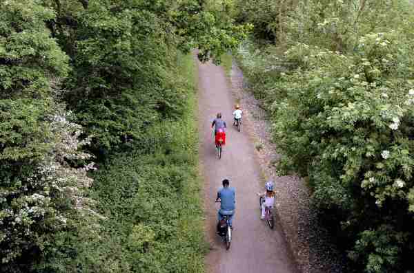
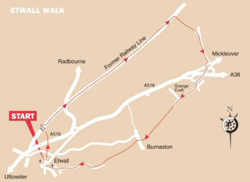
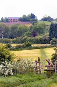
ETWALL WALK THE WALK A very satisfying walk, a little longer than usual for this series, but easy level walking through fields, along the bed of a former railway line and beside the road. After leaving Etwall you soon join the former Great Northern Railway Line that linked Derby’s Friargate Station to other lines at Egginton Junction. The line was closed for regular passenger service in 1939 and 25 years later for goods traffic, although it remained open for a further four years for testing purposes. The track-bed has now been resurfaced for public use. Residential housing now takes up the grounds of the former Pastures Hospital, which opened in 1851, as the Derbyshire Pauper Lunatic Asylum. Once freed of chains and restraints that they had experienced elsewhere, the patients found that not only were they given proper care and attention, but also that there were opportunities for recreation and relaxation amidst beautiful countryside. The pretty village of Burnaston is visited briefly on the return journey, before you set off again across the fields. The huge Toyota development, located where Derby Airfield once had its home, comes into sight before Etwall is reached.
WALK DETAILS Length: 8.5 miles. Start/Finish: St Helen’s Church, there is usually some parking space on Church Hill, but please avoid service times. Location: Off the A516 Derby to Uttoxeter road, take the ‘Etwall’ sign off the bypass. Terrain: Easy, level walking through fields and along surfaced paths.
THE ROUTE 1. Walk up Church Hill and along the narrow path to the right of Etwall Cricket Ground, cross Sutton Lane and continue down the sign posted track opposite a stile. 2. Cross the stile and keep to the left down the field, go over a stile and cross the Etwall bypass and another stile on the other side of the road. 3. Keep the hedge close on your left until it bends to the left, when you continue ahead to a stile on the other side of the field. 4. Cross the bridge over the disused railway line and immediately turn right, descend a flight of steps to the surfaced path below, where the railway track used to run. 5. Walk up the path for nearly three miles, before leaving at Black Wood. Turn right over a stile to cross three fields, keeping close to the hedge on your right to reach Greenside Court, Mickleover. 6. Turn right at the end of the cul-de-sac and walk along Ladybank Road to the roundabout and cross the road heading for the Mickleover Court Hotel. 7. Continue in a westerly direction and take the first road on the left, turn right along Hospital Lane, past Grangecraft Garden Centre (now Mickleover Garden Centre). When the road bends sharply to the left, you carry straight on down a tarmac path leading to the top end of a cul-de-sac. 8. After about 75 yards, follow the pathway indicated by a finger post sign. At first the path is enclosed, but soon opens out and follows an obvious route to a track just to the left of Bushy Cottage. 9. Cross the track and angle slightly to the right across the field, heading for the stile in the bottom right hand corner. 10. Turn right down a grass track and, within a few yards, go left at a footpath sign into a field. Continue up the field and walk on the left hand side of a wooden fence near the top. 11. Go over the stile at the top of the field and walk between some houses, and descend a flight of steps to the road through Burnaston village. 12. Turn right down the road and after a few yards go to the left down Tinderbox Lane. 13. Enter a small field and follow the boundary round to a stile on the left, turn right and keep close to the hedge in the next field. 14. Cross two stiles divided by a track and continue straight on to a stile at the top of the field. 15. Once over the stile, keep to the left through a copse to reach the next field and continue straight ahead along an obvious track leading to Sandypits Lane. 16. Follow the lane round as it winds its way into Etwall, turn right at a ’T’ junction of roads and then right again at the Main Street, from where you can see Church Hill on the opposite side of the road.
Return to the Home Page Back to the top of the Page Return to the Contents Page www.derbyshire-peakdistrict.co.uk is an independent, not for profit website. No recommendation of any establishment is implied by inclusion on this website.
|
PLACES OF INTEREST IN THE LOCALITY Highfields Happy Hens, Heage Lane, Etwall (Tel. 01283 730980) a very special place offering a loving, working environment to young people with special needs whilst producing real free range eggs and other environmentally friendly produce. Farm Shop, open Monday – Saturday. Visitors welcome to look around. Telephone for details of open days. Sudbury Hall and Museum of Childhood: (Tel. 01283 585305) the hall includes superb plasterwork ceilings and Grinling Gibbons carvings. Please telephone for opening details or visit website. Derby Cathedral (01332 341201) dominates the skyline with its impressive Perpendicular Tower, the second highest in England to the Boston Stump. Light and spacious inside, the iron screen by Robert Bakewell is an inspirational masterpiece in this proud and beautiful building. Concerts and special events take place throughout the year. Open daily. REFRESHMENTS Etwall Post Office Tea Rooms (Tel. 01283 732399) situated in the heart of the village, at the front of the Post Office. The premises are light and airy. Hot and cold drinks are provided with a choice of pastries and filled rolls and cobs. Hot snacks are also available in cold weather. Open Monday to Saturday. World Peace Cafe, which is located within the grounds of Ashe Hall. Both Ashe Hall and the World Peace Cafe may be places of interest to people visiting the local area. Click here for more information. Hawk and Buckle (Tel. 01283 733471), in Etwall, is a popular village pub offering a good range of meals. When the circus used to visit Etwall, the elephant was accommodated in the stable yard at the rear, now humans relax there with a pint. Open all day. Meals served at lunch times Monday to Saturday (on Sunday - roast only). Evening meals served from Monday to Friday.
THE DISCOVER DERBYSHIRE AND THE PEAK DISTRICT GUIDE
Provides a wide range of features on towns and villages with heritage trails and detailed countryside walks, through some of the most scenically attractive countryside in the UK.
The site is expanding to include many other features of interest to the local person and visitor alike. Why not bookmark this site for future reference. 1. To return to the main site click the link below. 2. To return to the contents page of the main website click the link below.
DISCOVER DERBY A special new sub-section has been added to this website, based on the Discover Derby Supplement, published by the Derby Evening Telegraph during March 2005. The most recent additions are: Click below for details.
ETWALL FEATURE
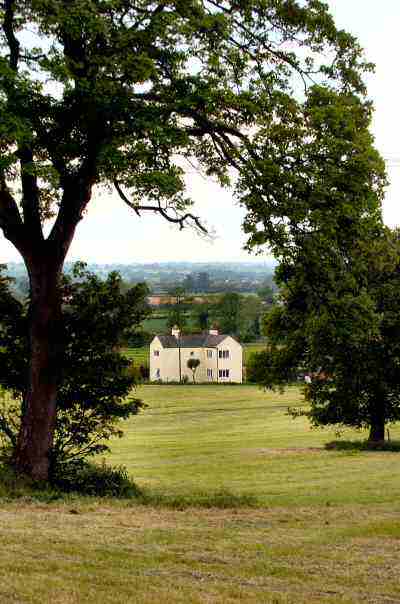
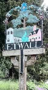
Etwall is situated to the south-west of Derby, and has grown enormously since the end of the Second World War, but still retains an attractive village centre. St Helen's Church and the Sir John Port Almshouses set on slightly rising ground are particularly appealing. The fine wrought-iron gates by Robert Bakewell, that hang outside the almshouses, restored in the 1980s, add an extra touch of quality.
Etwall remained a fairly small rural village until the 20th century. However, gradual improvement in communications and people prepared to travel further to work, meant Etwall became an attractive place to live. During the period from 1951 to 1981, the population trebled. This put the local schools under severe strain.
All details on this page were correct at the time of publication, but changes may be made without notification. |