DISCOVER DERBYSHIRE
AND THE
PEAK DISTRICT
|
DISCOVER DERBYSHIRE AND THE PEAK DISTRICT |
|
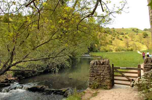
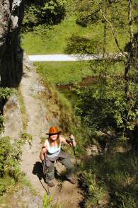
DOVEDALE THE FEATURE Please read the note at the bottom of the text as it could affect any walk you have planned. The River Dove rises on high ground at Axe Edge, near to Buxton. Its clear waters meander southwards for 45 miles to eventually join the River Trent. For much of its course, the river runs through stunningly attractive countryside, with one bank in Derbyshire and the other in Staffordshire. It is a walker's paradise, providing both easy walks for the casual walker as well as more strenuous hikes for the more experienced practitioner.
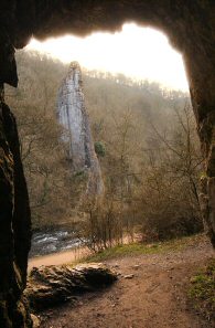
Dovedale, with its steep-sided limestone sides and tree-covered slopes is the stretch of the valley that runs from the tiny hamlet of Milldale, down to the large car park close to the road linking Ilam and Thorpe. In some places the water has eroded the limestone into spectacular rock formations, like the Lion's Head and the natural archway in front of Reynard's Cave. For the more energetic who climb Thorpe Cloud or Bunster, there are fine views across the valley.
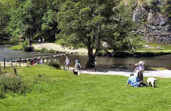
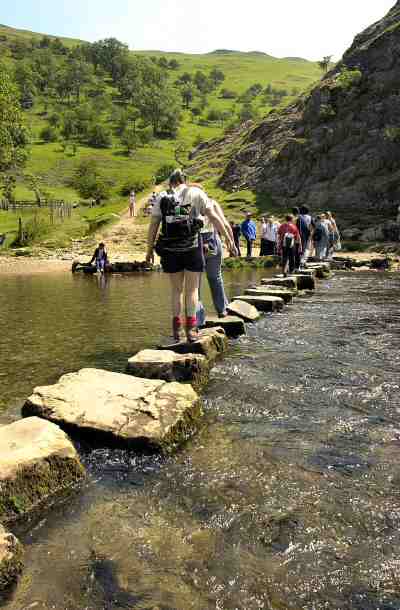
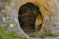
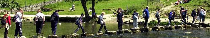
The building of the Midland Railway in 1863 made the Peak only three hours from London. Many were the thousands who got off the train at Alsop-en-le-Dale Station and walked the length of Dovedale before catching a train home at Thorpe Station. The railway is no more, but cars still bring thousands of visitors to what is one of England’s most famous beauty spots. A high proportion of the 22 million people who visit the Peak District National Park, include the Dove Valley in their itineraries. According to a footpath count in Dovedale on a typical August Sunday in 1990 recorded 4,421 walkers on the Staffordshire bank of the river and 3597 on the Derbyshire side. Photographs of the stepping-stones across the Dove must have appeared on more calendars and gift boxes of all shapes and sizes than any other countryside scene in England. They are quite stable and children of all ages love to cross them. Although after heavy rainfall they can become submerged in the river, when only the sure footed should cross. There is a full-time Ranger Service, and the National Trust Warden Service based at Ilam Hall, which offer help and advice to visitors. A good place to visit for more information is the National Trust Information Centre and shop at Ilam Hall, where there are also excellent tearoom facilities. The National Trust also have a small Information Centre and at Milldale, in what was once part of a mill.
Milldale is a delightfully positioned hamlet at the northern end of Dovedale. It attracts walkers like few other places of its size in Britain. Most come to explore the beautiful Dove Valley, with its famous Stepping Stones and strange rock formations, but there are many other excellent walks in the area that either start, or pass through Milldale. The ancient packhorse bridge, over the River Dove, crossed by hundreds of walkers on a fine day at the weekend at any time of the year, is the most famous of all in the Peak District. It is known as the Viator’s Bridge, and was made famous in the English classic The Compleat Angler by Izaak Walton. In the fifth edition, published in 1676, Charles Cotton of nearby Beresford Hall wrote an addendum about fishing, introducing the reader to two travellers - Charles Cotton (Piscator) and Izaak Walton (Viator).
In the days when the two travellers would have approached the narrow bridge at Milldale, it would not have had any walls and must have looked quite frightening to cross. Bridges then were designed with low parapets to allow horses carrying panniers to cross without obstruction. Viator commented on seeing the bridge: ‘Why! A mouse can hardly go over it: ‘tis not twelve fingers broad.’ Milldale Bridge is now known as Viator’s Bridge and its name is clearly in view to all that cross.
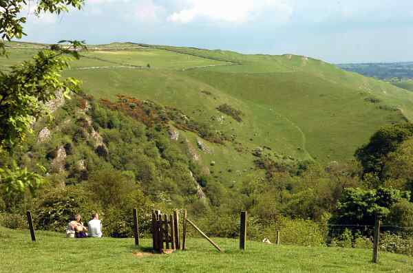
Now the valley is given over mainly to tourism, but the sheer volume of visitors has been instrumental in the erosion of the path along the side of the river. A great deal of remedial work has been undertaken to provide the walker with a safe pathway through Dovedale. It is best to try to avoid visiting the valley at weekends, particularly during the summer and at peak holiday times. Unless you like crowds and do not mind running the risk of having car parking problems.
MESSAGE FROM STAFFORDSHIRE
HIGHWAYS: I am
contacting you in relation to a bridge deck replacement and disabled access
upgrade of Ilam Rock Footbridge in the Dovedale Valley, which Staffordshire
County Council is proposing to undertake starting 8th September 2008 for a
duration of 10 weeks.
Riverway Stafford ST16
3TJ
Return to the Home Page Back to the top of the Page Return to the Contents Page www.derbyshire-peakdistrict.co.uk is an independent, not for profit website. No recommendation of any establishment is implied by inclusion on this website.
|
DOVEDALE Dovedale is one of England's most attractive beauty spots. It is situated about six miles north of Ashbourne and can be accessed easily, outside peak visiting periods, from both the A515 and the A52(A523). It was described by Ruskin as ‘An alluring first lesson in all that is beautiful’. Byron, wrote with Dovedale in mind, to his friend the Irish poet Tom Moore, ‘I can assure you there are things in Derbyshire as noble as Greece or Switzerland’
PLACES OF SPECIAL INTEREST IN THE LOCALITYIlam Park the 158 acres of the park is managed by the National Trust. It lies on the banks of the River Manifold and includes a walk along an avenue of Lime Trees known as Paradise Walk. There is a National Trust shop, information centre and tearoom and entrance to the grounds is free to walkers. Tissington Trail following the closure of the railway line, the track was converted into a trail and ever since has been popular with walkers and cyclists. The trail links up with the High Peak Trail. You can now either walk or cycle through some of the White Peak’s finest scenery without ever seeing a car! Ashbourne is one of Derbyshire’s finest towns, with a wealth of Georgian architecture. The triangular cobbled Market Place holds markets twice per week on Thursday and Saturday.
THE DISCOVER DERBYSHIRE AND THE PEAK DISTRICT GUIDE
Provides a wide range of features with heritage trails and detailed countryside walks, through some of the most scenically attractive countryside in the UK.
1. To return to the main site click the link below. 2. To return to the contents page of the main website click the link below.
DISCOVER DERBY A special new sub-section has been added to this website, based on the Discover Derby Supplement, published by the Derby Evening Telegraph during March 2005. The most recent additions are: Click below for details.
BOOKMARK
Bookmark this site so as not to miss other town/ village features, heritage trails and countryside walks to be published shortly. Plus many more interesting features.
ON THIS SITE Every month an illustrated Newsletter is published giving details of: What's New, What's Coming and What's On.
All details on this page were correct at the time of publication, but changes may be made without notification. |