DISCOVER DERBYSHIRE
AND THE
PEAK DISTRICT
|
DISCOVER DERBYSHIRE AND THE PEAK DISTRICT |
|
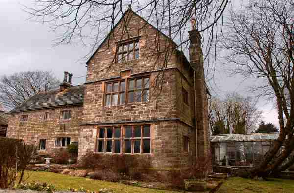
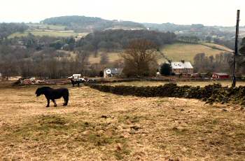
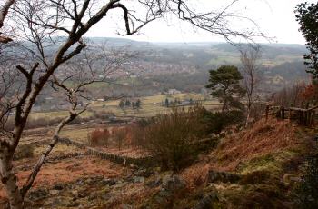
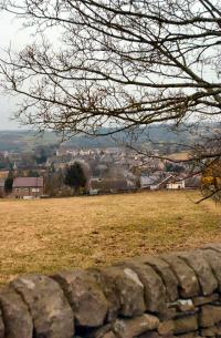
TANSLEY WALK THE WALK This is only a short walk, but nevertheless a very enjoyable one. It combines a visit to the charming little village of Riber, with some outstanding views over the surrounding countryside. The route back to Tansley can be quite slippery in wet conditions and the walker needs to be well shod. The gentle climb up from Tansley brings you to the ancient hilltop village of Riber. The Manor House of 1633 and the Elizabethan, Riber Hall, now a hotel, are particularly noteworthy. The village though is best known for its castle, which can be seen for miles. John Smedley, who built the Hydro a t Matlock, had Riber Castle constructed with battlements on a site offering almost unparalleled views of the Derwent Valley. After he and his wife died it was put to several uses, including that of a preparatory school and a food store during the Second World War. Most unusually it also became the home of a wildlife park for a number of years, but now sadly its grounds lie empty and the castle in ruins. As you return there are excellent views over Matlock and Tansley and Lumsdale, one of the oldest industrial valleys in the country.
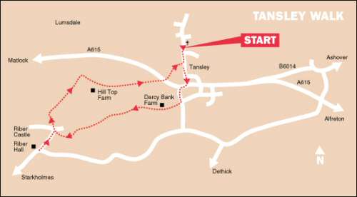
WALK DETAILS Length: 3 miles. Start/Finish: Park along the roadside close to the Church, in Church Street. Location: At Tansley turn north off the A615 Matlock to Alfreton Road. The road widens out between the church and recreation ground to provide a suitable parking area. Terrain All the ascents are gentle, but the descent from Riber can be quite slippery after wet weather.
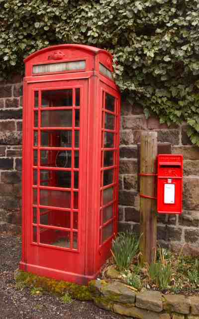
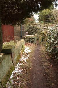
THE ROUTE Walk back along Church Street to the A615, turn right and walk down the pavement for 100 yards, before crossing the road and ascending Alders Lane. 2. Opposite Dickins Place on the edge of the village, turn right at the footpath sign and walk along the access road to Daisy Bank Farm. 3. Before reaching the farm take a stile on the left into a field, turn sharp right and continue straight ahead past the farm. 4. Cross a stile on the right, maintain the same direction but now with the field boundary on your left. 5. With Riber clearly in view, continue in the same direction along an obvious path, before going slightly to the left, cross a farm access road and stile into another field. 6. Keep to the left by the field wall, go over a stile and turn right, walk a few yards up the field to a stile by a metal gate, on the other side of which is the village road. 7. Here you can take a short diversion to admire the village, by turning left and walking as far as Carr Lane, before returning to point number 6. 8. Walk about 20 yards along the road towards Riber Manor and then turn left and almost immediately right down a rough track by the side of telephone and post boxes. 9. Keep to the right past a house and enter a field, walk across two small fields to reach an area of open ground. 10. Turn sharp right; follow the well trodden path close to the wall on the right. The path eventually leaves the wall and starts to descend zigzagging down the hillside to a stile into a field. 11. Walk down the field a short distance, but before reaching the bottom take the stile on the right. Cross the next two fields angling to the right and follow a path just to the left of Hilltop Farm. 12. Go through the gateway near the farm and bear left, continue along a rising grass track with the wall on your right. Do not follow the track winding downhill. 13. Maintain the same direction, as the track soon becomes enclosed and eventually leads you down to the A615. 14. Cross the main road to a footpath sign, follow the path down to a footbridge over a stream. 15. After crossing the stream, keep to the right to the top of a field and turn right. A few yards further on go to the left up Church Street back to the start of the walk.
Return to the Home Page Back to the top of the Page Return to the Contents Page www.derbyshire-peakdistrict.co.uk is an independent, not for profit website. No recommendation of any establishment is implied by inclusion on this website.
|
PLACES OF SPECIAL INTEREST IN THE LOCALITY The Heights of Abraham (Tel. 01629 582365) take a spectacular journey by cable car to explore two show caverns, follow woodland trails. Enjoy the magnificent view from the Treetops café and restaurant. There is a children’s play area. Please telephone for details or visit website. Mining Museum and Temple Mine (Tel. 01629 583834) is where you get a very realistic impression of what the conditions used to be like for men who toiled underground. After completing your absorbing tour of the museum you can visit Temple Mine. The museum is open daily throughout the year. Temple Mine is open on a reduced basis in the winter. Peak Rail (Tel. 01629 580381) is a preserved railway operating steam trips from Matlock Riverside Station to Rowsley South calling at Darley Dale. Telephone for full operating details. REFRESHMENTS Tavern at Tansley (Tel. 01629 57735) at one time known as the George and Dragon, it was originally a farmhouse, where ale was served from the kitchen. Open lunchtime and evenings Monday to Saturday and all day Sundays. Food served lunchtime and evenings. There is a children’s play area, and an adults only garden at the rear. Accommodation is available. The Heathers Coffee Shop (Tel. 01629 583036) situated at Tansley, on the B6014 just off the A615. The Coffee Shop is housed in Scotland Nurseries and provides first class food and service with an extensive range of hot and cold meals. Open daily.
THE DISCOVER DERBYSHIRE AND THE PEAK DISTRICT GUIDE
Provides a wide range of features on towns and villages with heritage trails and detailed countryside walks, through some of the most scenically attractive countryside in the UK.
The site is expanding to include many other features of interest to the local person and visitor alike. Why not bookmark this site for future reference. 1. To return to the main site click the link below. 2. To return to the contents page of the main website click the link below.
DISCOVER DERBY A special new sub-section has been added to this website, based on the Discover Derby Supplement, published by the Derby Evening Telegraph during March 2005. The most recent additions are: Click below for details.
TANSLEY FEATURE Situated on the edge of Tansley Moor, in attractive countryside, one and half miles east of Matlock is the village of Tansley. It straddles the main road to Alfreton, and its main street, Church Street, leads off in a northerly direction. The climate is bracing, the water supply good and the scenery beautiful. All this once made the village a pleasant resort for visitors and invalids who came to take the waters at the hydropathy. Fast flowing streams brought industry to the locality and several mills were built in Lumsdale, which became part of the parish of Tansley, in 1865. They provided additional employment to the faming and quarrying being carried out in the area. At one time some seventeen mills all drew their power from one small, but rapidly descending stream, the Bentley Brook. Dams were constructed on the very steep hillside so the mills could operate.
All details on this page were correct at the time of publication, but changes may be made without notification. |