DISCOVER DERBYSHIRE
AND THE
PEAK DISTRICT
|
DISCOVER DERBYSHIRE AND THE PEAK DISTRICT |
|
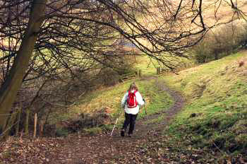
STANTON-IN-PEAK WALK THE WALK This is a lovely walk through beautiful limestone country that takes in some superb views. The walk climbs up steadily from Rowsley to reach the edge of Stanton Moor, before exploring Stanton and then returning through the fields.
Stanton Moor is famous for its Bronze Age relics, the best known are The Nine Ladies Stone Circle. Legend has it that the nine ladies danced here on the Sabbath Day and were turned to stone as a punishment, along with the fiddler who stands nearby. Last century, the Heathcote family excavated in excess of 70 burial mounds on the moor.
On the edge of Stanton in the Peak, your route takes you past the local cricket ground that must have one of the prettiest views in the country, which you might want to take a short detour to visit.
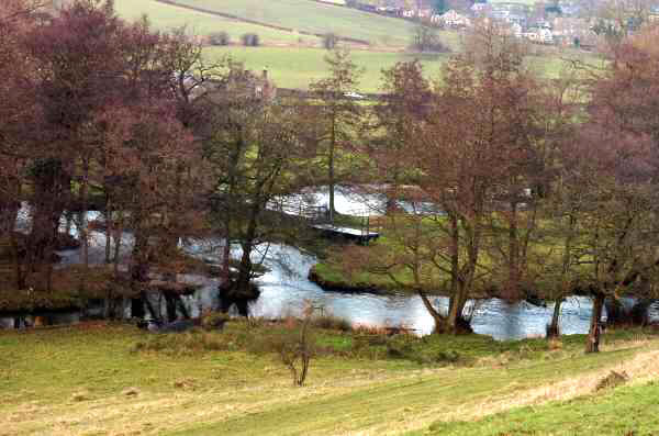
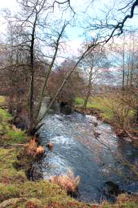
Continuing on your journey down the hillside, you go through the tiny hamlet of Congreave before the walk levels out. It then follows the beautiful River Wye almost back to the start of the walk. Rowsley is well worth exploring and Caudwell’s Mill and Craft Centre, in particular, should not be missed.
WALK DETAILS Length: 5 miles. Start/Finish: Roadside pull-in by the Recreation Ground on the road to Stanton. There is also a public car park virtually opposite the Grouse and Claret. Caudwell's Mill Car Park is strictly for patrons only. Rowsley has been chosen as the starting point of this walk rather than Stanton in Peak, because it can be virtually impossible to park safely at the latter during busy periods. Location: Off A6 at Rowsley, between Matlock and Bakewell. Terrain: Mainly through open countryside along easy to follow paths and quiet lanes. Some steady climbs and descents, but nothing particularly strenuous.
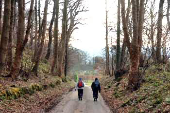
THE ROUTE 1. From the car park, walk down the lane signed for Stanton Lees. Continue along the lane as it gradually climbs through Holly Wood.
2. Leave the lane to the right at a footpath sign and, keeping close to the wall on the left, climb a short hill.
3. After 40yards take the next footpath sign on the left and immediately bear right onto a stony track leading past Stanton Woodhouse Cottages and Farm.
4. Pass through a metal gate in front of you into a field and follow an obvious path that soon curves to the right and then bends to the left.
5. Go through an open gateway and angle to the right to follow the path as it passes Endcliffe Quarry.
6. On reaching a stile onto a road turn right and at a ‘T’ junction of roads turn left to walk uphill.
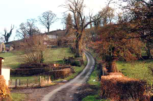
7. Follow the road all the way to Stanton and walk down the village street, until a few yards after passing the church, you turn right to pass the post office/shop and school.
8. After going through a gate continue straight on, with the wall close on your left. Pass through a gateway into the next field and head towards the top end of a wood.
9. Shortly after passing the wood, go through a gateway and angle slightly left through three fields.
10. Head diagonally down the next field, aiming just to the right of two trees about 80 yards from the bottom corner.
11. Walk to the bottom right hand corner of the next field to enter another field. In this field aim towards a fingerpost sign you can see in the distance on the right.
12. Turn right and walk up Stantonhall Lane to the tiny hamlet of Congreave. Turn left at the next footpath sign and after a few yards you enter a field by a stile.
13. Follow the path to the right as it leads round the base of the hill to a stile in the far corner.
14. Go through two gate stiles in quick succession into a small wood and follow the path to a stile. Cross the next field angling slightly to the right, towards a line of trees, to join a green farm track.
15. The grassy track eventually brings you close to the water’s edge. Continue along a farm track to a wooden fence stile by a metal gate, to gain access to the road.
16. Turn left along the road to reach Rowsley in about a quarter of a mile.
Return to the Home Page Back to the top of the Page Return to the Contents Page www.derbyshire-peakdistrict.co.uk is an independent, not for profit website. No recommendation of any establishment is implied by inclusion on this website.
|
PLACES OF SPECIAL INTEREST IN THE LOCALITY Caudwell’s Mill, (Tel. 01629 734374) powered by the River Wye is the only complete Victorian working roller flour mill in the United Kingdom. Open daily. In addition, there are a number of craft shops; also a well stocked gift shop, artist’s gallery and café.
Peak Village (Tel. 01629 735326) is the Peak District’s first and only factory outlet shopping centre, set in beautiful surroundings at Rowsley. Open every day. Peak Rail (Tel. 01629 580381) is a preserved railway operating steam trips from Matlock Riverside Station to Rowsley South calling at Darley Dale. Telephone for full operating details. REFRESHMENTS Grouse and Claret (Tel. 01629 733233) formerly the Station Hotel, but due to the demise of the railway it was renamed. A grouse and claret is the name of a specialist dry fly used in trout fishing in the locality. Food is served at lunchtime and in the evenings. There is a Beer Garden and children’s play area. Accommodation is available. Caudwell Mill Tea Rooms (Tel. 01629 733185) have an excellent reputation for food and serve both hot and cold meals. If it seems a little like sitting in church there is a reason. The seating and serving counter have both been salvaged from Crich Carr Chapel when it closed. Open daily.
THE DISCOVER DERBYSHIRE AND THE PEAK DISTRICT GUIDE
Provides a wide range of features on towns and villages with heritage trails and detailed countryside walks, through some of the most scenically attractive countryside in the UK.
The site is expanding to include many other features of interest to the local person and visitor alike. Why not bookmark this site for future reference. 1. To return to the main site click the link below. 2. To return to the contents page of the main website click the link below.
DISCOVER DERBY A special new sub-section has been added to this website, based on the Discover Derby Supplement, published by the Derby Evening Telegraph during March 2005. The most recent additions are: Click below for details.
STANTON-IN-PEAK FEATURE Stanton in Peak is an attractive mainly gritstone built village, with fine views over the River Wye towards north Derbyshire. Its main street winds its way steeply up the side of Stanton Moor, from where most of the stone used in construction of the village originated from. Stanton Moor, rising 1096 feet above sea level, overlooks the village. The Moor is an isolated gritstone outcrop in the heart of limestone country and one of the richest prehistoric sites in Derbyshire. The village is very ancient, having been granted a Royal Charter in 968. Many of its houses date from the 17th and 18th centuries. The houses built in the early part of the 19th century, which carry the initials ‘WPT’, were built by William Pole Thornhill. The Thornhill family also built the tower on the eastern edge of Stanton Moor that bears the inscription ‘Earl Grey 1832’. This commemorates of Earl Grey’s Reform Bill, which led eventually to every Englishman having the right to vote. Stanton Hall hides behind a high wall along the village street, but to the west it commands magnificent views. It was the home of the Thornhill family for many generations, who were responsible for the majority of buildings in the village.
All details on this page were correct at the time of publication, but changes may be made without notification. |